
The South of the island of Maui is probably the least visited part of the island and yet it is one of the wildest! We fell in love with these solitary landscapes, hurtling down the slopes of Haleakalā to the deep blue ocean.
These landscapes are crossed by only one road: the famous Highway 31 or Piilani Highway. But many people are wary of this little-known road of only 36 km.
We will therefore first explain to you why there is such apprehension towards Highway 31 and then we will show you the different landscapes you will cross on the Piilani Highway. We will begin this adventure from the last few kilometers of Highway 37 to the Kalepa Bridge in the southeast, which marks the end of the Piilani Highway and the beginning of the road to Hāna.
Summary
1Why is the Piilani Highway scary?
The Piilani Highway is the only road that serves the south of the island and it has the peculiarity of having a 10 km stretch where the roadway sometimes narrows to a single lane in sharp bends, as well as a few sections of gravel or of dirt.
Quite honestly, if you're comfortable with the small mountain roads, you'll have no trouble getting here! You will be able to judge for yourself on the few pictures in this article.
However, since some Americans are not used to this kind of road, car rental companies often insist at the counter to dissuade you from taking the Piilani Highway, just like on Route 340 in the northwest of the island. Some even say that these roads are simply forbidden or that you will not be insured.
To be sure, check your rental contract, but usually the contract specifies that only unpaved roads are not insured, except those portions are fairly short on Highway 31 and are only present in the last 10 kilometers.
In short, if you feel comfortable, we recommend that you come all the way out here because it's clearly worth the trip, which will also allow you to take the grand tour of East Maui and avoid the long and winding road of Hāna in both directions (which to my taste is really much harder to drive).
2The Piilani Highway: from Highway 37 to Kalepa Gulch
Highway 37 is a road that connects Kahului to the beginning of the Piilani Highway. This road crosses Maui from north to south along the first gentle slopes of Haleakalā and passes through the small towns of Pukalani, Kula and Keokea. The interesting part starts when leaving Keokea. From here the houses will become rarer and the road gently descends towards the Pacific.
The first views of the ocean appear progressively as soon as the vegetation spreads. We are high enough to overhang the whole southern tip of Maui, and on a clear day, we can see very well the western part of the island in the distance.
Panorama from Highway 37
About 200m before the beginning of the famous Highway 31, a small place on the lower side of Highway 37 allows to stop to observe a nice panorama of the surroundings.
In the background, ancient volcanic cones covered with greenery face the ocean, testimony to the active past of the island whose last eruption dates back to 1750. Behind the cones we can see the beautiful La Perouse Bay and the small martyr island of Kaho'olawe, which was used as a test bombing target between 1941 and 1990, now being restored and forbidden to the public.
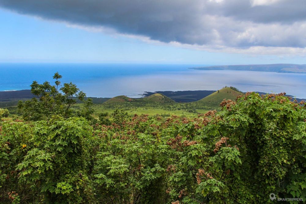
From here, the view on the ocean won't leave us until the end (well almost)!
We are now on Highway 31. The road goes around the impressive Haleakalā from the south along its sides that go down to the sea. The road is wide, rather straight and follows the relief of the old coulees now wooded, where a few cones are scattered here and there.

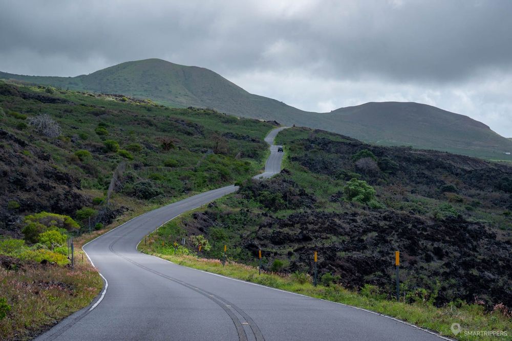
There are already fewer cars here. Houses are becoming scarcer and eventually disappear in favor of the meadows that cover the old lava fields. The road is more and more straight and now seems to plunge straight to the ocean. The wide highway gives way to a long and beautiful strip of asphalt that is a bit narrower but without any difficulty to cross (there are few vehicles here).
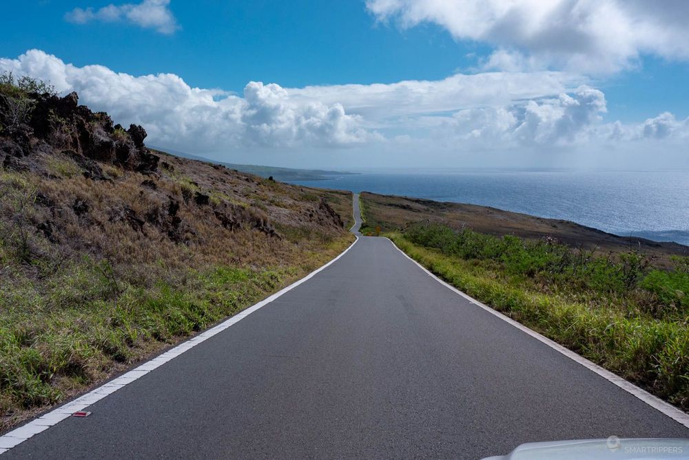
As the road descends and continues eastward, the landscape opens up to the foothills of Haleakalā whose southern side can now be seen, often dominated by the clouds that pile up on the heights. This part of the island is also more desertic because it is drier and sunnier thanks to the clouds that get stuck on the other side of the big volcano.
It is not uncommon to have rain on the first part of the road and to find great sunshine when arriving south of Haleakalā near the ocean.
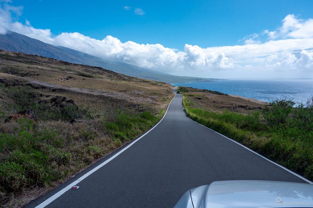
The colors also change according to the seasons. Towards the end of the year, the rain waters more abundantly the meadows which begin to green up. In spring light green is the dominant color. Little by little drought will return and the volcano slopes will regain their yellow and brown tones during summer and early winter.
That's it, the road now reaches the ocean. The scenery changes. The slopes of the volcano are carved by successive rocky gulches where small single-lane reinforced bridges have been built to cross them, which can be severely tested during violent floods.

Manawainui Gulch
Be sure to stop at the side of the road just before reaching the gulch. There is an area where you can park on the sea side. You will be able to walk near the edge of the ancient lava flows that are gradually being nibbled by the tumult of the water and have a beautiful view of the ocean.
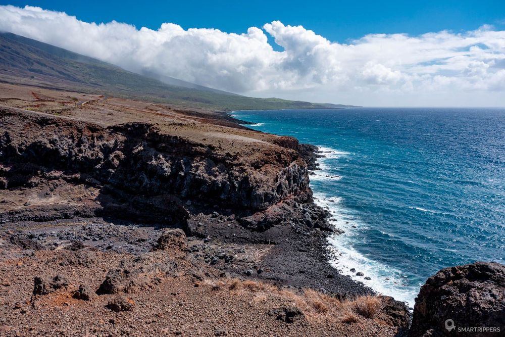
The road continues for some time in this chaotic setting of black rocks interspersed with gulches. The road narrows with every new crossing. Of course, you will have to adapt your speed when you pass the small narrow bridges.

Still no difficulty to report here, the road being in good condition and traffic very low unlike the Hāna highway.
Small natural arch
A small natural arch is hidden below the cliffs at the base of the small rocky outcrop just before the Poopoo Gulch.

You probably won't see it if you are coming from the West, but it will be clearly visible on your left if you drive the other way. Coming from the west, after passing Manawainui Gulch, stop at the first place you see on the right side of the road and walk towards the edge of the cliff. There you will discover the small arch that will only be revealed at the last moment. You can also choose to make a quick stop at the side of the road, in the wide bend just after crossing the bridge of the Wai'Ōpae Gulch, to get the most beautiful view of it.

The road now continues in a straighter line, skirting the ocean slightly higher up. The rock gives way again to meadows and a few trees appear soon forming a small scattered forest. The place is much greener, one feels that the humidity is stronger. Moreover it is possible that the clouds may come back again, the top of Haleakalā being just above (well, at least at about 3000m from there!).
The road also widens in this wooded area, again drawing two lanes separated by a yellow line.
After the small forest, place again to the grassy meadows. It is here, at the level of Mamalu Bay, that the pretty asphalt road stops, suddenly giving way to an asphalt road patched on all sides and pierced in places which marks the beginning of the area considered "at risk". This less travelled and rather narrow portion will continue until the end of the Piilani Highway, i.e. for about 10 km, and will continue afterwards for the first few kilometers of the Hāna highway.
But don't panic! Remember to anticipate crossings with other vehicles by looking away if no one is approaching. Don't worry, there is nothing impassable.
In places, a newer, cleaner coating will alternate with a few patched or uncoated portions, sometimes with potholes. The two pictures below show you the worst of what will await you.
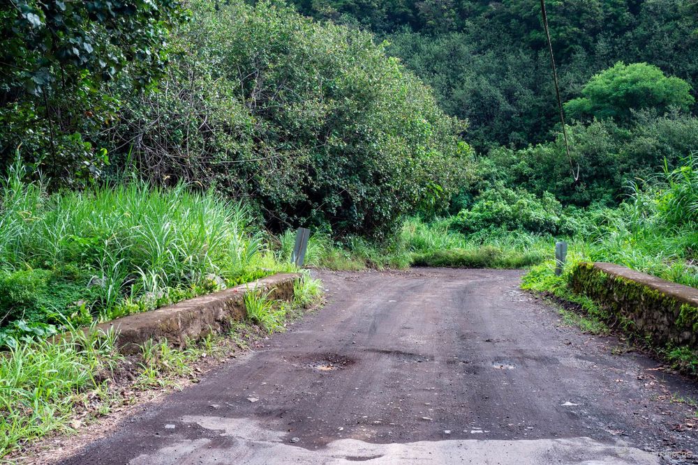
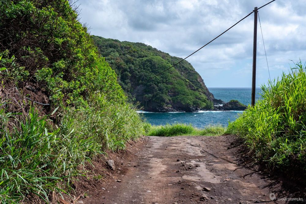
But we reassure you, these areas are very short, the road being mostly paved or with small gravel without too many holes.
At the exit of the small village of Kaupo, the road joins the seaside and will follow it until the end, following the curves sometimes on the side of rocks, marrying the topology of the ground and skirting the gulchs.
The most visually impressive area is at the last kilometer, just before reaching the Hāna highway. At this point, the road bends out of sight, overlooking the sea on one side and skirting a stretch of rock on the other.
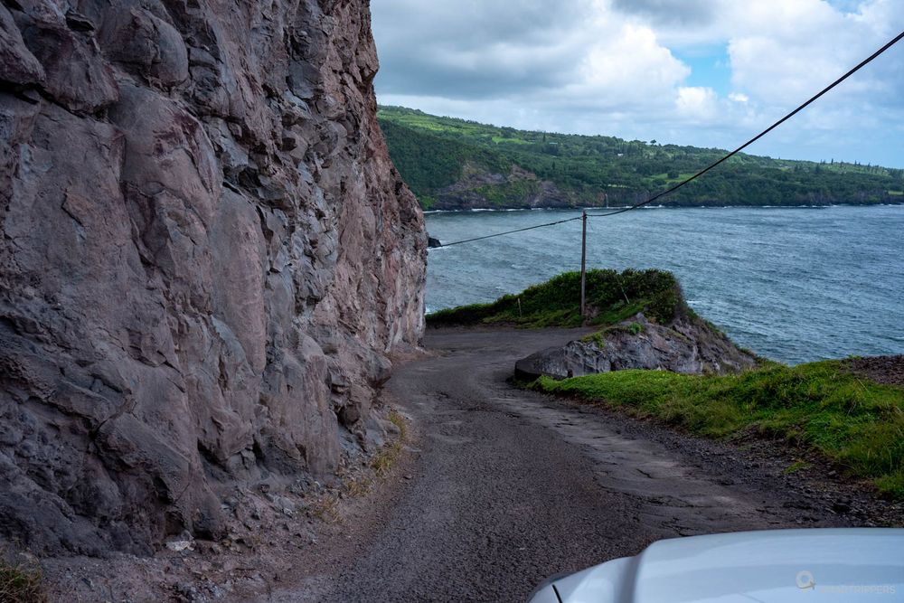
By limiting your speed and honking your horn to signal your presence, this last obstacle should not be a problem for you.
After this last bend, the Piilani Highway reaches its ultimate goal: the Kalepa Gulch, where it passes the relay to the Hāna highway at the end of a small black pebble beach.


3Our advice before taking the Piilani Highway
How long does it take to drive the Piilani Highway?
In terms of timing, it will take about 1 hour to cover the entire 36 km Piilani Highway without counting the few photo stops. If you wish to continue on the road to Hāna to do a grand tour of East Maui, count a big day by leaving early because the Hāna highway is long and the points of interest are numerous.
It can also be very wise to stay one night at Hāna, but accommodations there are expensive and you will be dependent on the somewhat capricious weather in this area of Maui.
Which way to go on the Piilani Highway
We recommend that you take this road from west to east so that you have the ocean on your right and can stop more easily to enjoy the panorama.
When should you drive the Piilani Highway
Ideally with a little sun to enjoy the beautiful ocean views that will probably be duller with clouds. The main interest of this route being the landscapes crossed, a rainy weather would not allow to take full advantage of it.
We are coming to the end of this article on the Piilani Highway. You now have all the cards in hand to decide whether or not to try the adventure.
We are Sandrine and Flo, French thirty-somethings. In 2019 we quit everything to live our dream, become nomads and travel around the world. We left with our baby, Lena, who was only 5 months old at the time. After a first trip around the Pacific Ocean by plane and a long 3 months stay in Hawaii, we left to discover Iceland for 3 months on board our 4WD pickup truck and truck camper. Then we continued our adventure in North America.
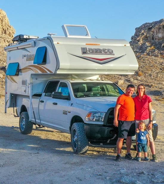
Today, if we can continue this adventure, it is above all thanks to our blog, Smartrippers! We created it one day in 2016, with the desire to share our good travel tips, without thinking that it would lead us there! We have developed it a lot over the years and have become experts on our 3 favorite destinations: Hawaii, Iceland and the American West. We now guide you to these destinations to help you plan the trip of your dreams!
Follow our adventures!