
The extreme north of the island of Maui is quite different from the rest of the island. This area, located at the northern end of its western part, offers a wild and green landscape. After miles of sandy beaches lined with residences and resorts, the coast becomes steeper and more rocky, the gulchs succeeding one another in a nature that seems almost untamed.
Although often discouraged because of its potential dangerousness, the Kaheliki Highway offers a unique experience of discovering another little-known facet of the Hawaiian Islands. Here, there are no spectacular scenery or paradisiacal beaches, but endless greenery as far as the eye can see that comes to rest in the blue of the ocean. In contact with the water, the rock is swept and eroded by the waves that sculpt and shape a chaotic coastline, dotted with small cliffs.
In this article, we will take the 35 km of the Kaheliki Highway from the end of the Honoapiilani Highway in the northwest to Wailuku, a town located west of Kahului. We will stop along the way to show you some of the sights, hikes and points of interest served by the Kaheliki Highway. But before we get to the heart of the matter, let's talk a little bit about the dangerousness of this road.
Summary
1Is the Kahekili Highway really dangerous?
To understand and answer this question, we must first understand that the Kahekili Highway is divided into 3 sections.
- The first section takes the end of Highway 30, in the extension of the Honoapiilani Highway. This section is a nice, wide and fairly smooth road that is safe. This section is drawn in green on the map at the bottom of the article.
- At the end of Highway 30, the pretty road with its beautiful yellow stripes gives way to a simple asphalt road that narrows to become very tight and winding after 2 km. This road is called Highway 340, but keeps its name of Kahekili Highway. It is this 13 km stretch that is known to be dangerous. It is the red section on the map.
- Finally, the last few kilometers of the Kahekili Highway (still known as Route 340) no longer present any difficulty, as the road widens again near the first residential areas. This is the yellow section on the map.
If you ask your rental car company if you can use the Kahekili Highway, chances are they will simply say "NO", as this road is dangerous because of its many bends and narrow sections where it is impossible to cross, even though it is only an 11 km section and not the entire road.
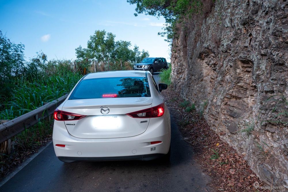
In order to avoid any risk of accident, the renters simply prefer to prohibit their customers from venturing out here, a bit like the Piilani Highway (Highway 31) in the south of the island.
Is this really justified? Personally, for having used this road several times, it is certainly tricky in several places that will require increased vigilance because the roadway is narrow and does not allow crossing, but it does not have vertiginous sections as we can find on some mountain roads in France or Europe for example. It will be enough to adapt your speed at the approaches and during all the narrow sections and to be able to reverse to a recess if you find yourself face to face with another vehicle. So I'm not afraid of it.
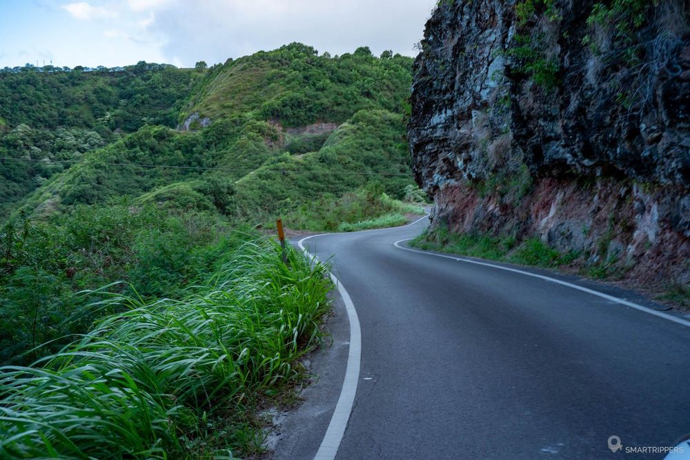

If you don't feel up to it, you may want to avoid this narrow section and turn back.
2Points of interest and hikes along the Kahekili Highway
The Kahekili Highway starts at the bottom of the gulch facing Honokōhau Bay, taking over from the Honoapiilani Highway. You will not see any change on the road which is for the moment beautiful, wide, not very winding and lined with a few shrubs.
From here, don't look for big parking lots or signs, there are none. All along the shoulder of the road you will see small dirt recesses on the shoulder of the road. Do not hesitate to stop at them, there will probably be a beautiful panorama or a point of interest to discover behind.
Let's take the Kahekili Highway eastward to stop at major points of interest.
Nakalele Blowhole
Here we are almost at the northernmost point of Maui, marked by a small cape surmounted by a very basic lighthouse which looks more like a beacon, the Nakalele Point Lighthouse. Here the waves crash against the rocks which offers a pleasant spectacle to contemplate when the ocean is agitated.
But the most popular attraction is the Nakalele Blowhole, a small geyser formed by the waves, which erupts as soon as a large wave engulfs under the rocks. To enjoy it, the sea must be rough, otherwise the spray will only take off a few centimeters and will not be very impressive.
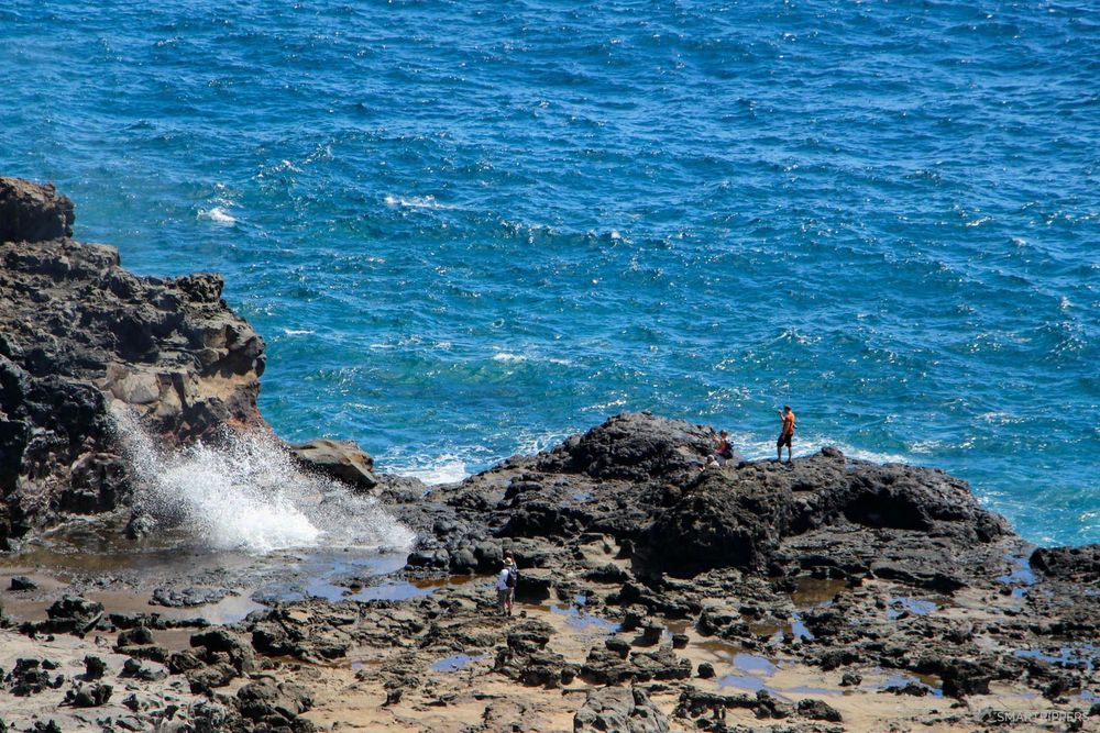
In heavy weather, the power of the waves is such that the water can be thrown several tens of meters from the ground.
Be very careful not to get too close to the Blowhole even if you see tourists at the base of the geyser. People have already died here, surprised and thrown up in the air by the water jet. Signs will remind you of this. It only takes one wave bigger than the others...
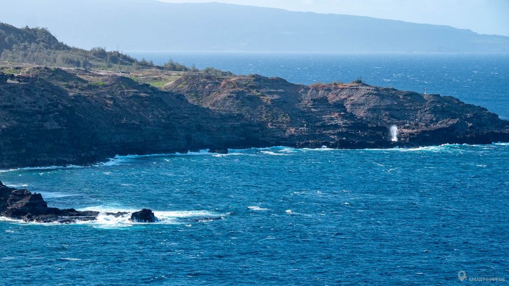
You can also take advantage of the place to go for a walk along the coast. The rocks take an astonishing shape as you get closer to the edge. One will regret however the too strong affluence which spoils a little the stroll. To find there a little calm, it will be better to come there early in the morning or at the end of the day.
How to get to the Nakalele Blowhole
Although the location is not indicated, it will be almost impossible to miss it as there are so many cars parked on the shoulder of the road above the Blowhole. There are several parking spaces along the road. Some hawkers even park there to sell their products.
You will then have to take one of the many small dirt paths that go down to the ocean. Be careful not to slip, some areas may be steep.
Ohai Loop Trail
Loop of 2 km - 30 minutes - Easy
If you feel like stretching your legs, you will enjoy this nice little 2 km loop among some endemic Hawaiian plants (signs will give you information) and beautiful ocean views.
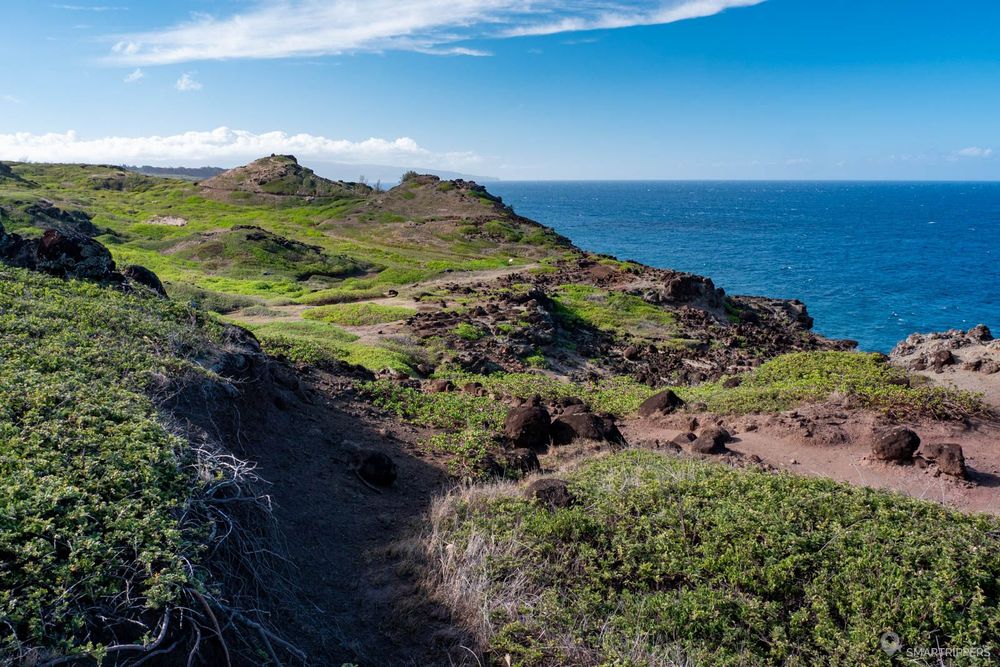
The trail is easy, fairly flat (slight difference in altitude of 90m) and winds its way through the small bushes of one of the endemic species. Benches are installed near the edge to contemplate the ocean. The place is peaceful because few people come to venture here, which is very pleasant. On the other hand, the interest of the hike remains rather limited, the landscape being rather monotonous on a large part of the trail.

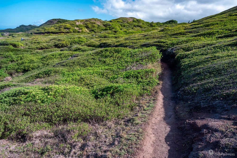
The loop can be done in both directions, depending on whether you prefer to start or end with the sea side section. Finally, a small, easily accessible belvedere a few meters from the parking lot offers a view of the coast. You may see the Nakalele Blowhole blowing in the distance if the ocean is agitated.
The place is also a good observation point to see whales in winter.
How to access the Ohai Loop Trail
A small concrete parking lot with about 8 spaces allows you to leave your car on the left side of the road. The path starts directly from the parking lot, just follow the signs.
Panoramic view of the coast
About 600m after the parking of the Ohai Loop Trail, don't miss the beautiful panorama on the coast. A small dent on the left side of the road (ocean side) allows you to leave your vehicle to take time to admire the scenery.
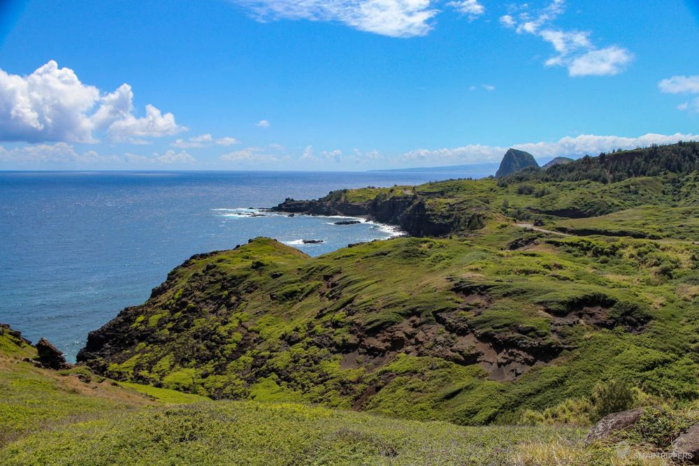
There is still 2 km to go before reaching the end of Highway 30, indicated by a small "End State Highway" sign on the shoulder of the road (which can easily be missed), which marks the transition to Highway 340. The beautiful Highway now gives way to a simple asphalt road that will gradually narrow.
Olivine Pools
Here is a popular place for an unusual but still very dangerous swim. Small natural pools are hidden at the bottom of the road, a few meters from the ocean. When the sea is calm, it is pleasant to come and swim in them, the water taking on a nice emerald hue. The water level varies according to the weather of the previous days, the waves more or less filling the small cavities.
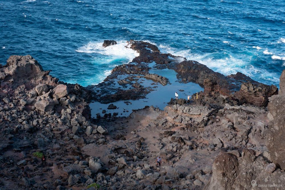
Nevertheless it is a place that we do not recommend because like the Queen's bath in Kauai, pools can sometimes be submerged by the waves which makes them extremely dangerous (only one wave is enough). As a reminder, a small stele on the path mourns the death of Steven, a 34 year old young man who was swept away in 2017 and whose body was never found.

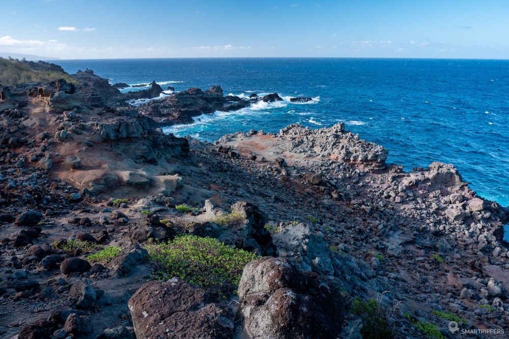
If you still want to swim there, you will have to go down a very steep and slippery path to reach the ocean, which is not well signposted.
How to access the Olivine Pools
A small dirt parking lot allows a few vehicles to park on the left side of the road (ocean side). From this parking point, you will have to look for the path that goes down there knowing that there are several ramifications that do not all lead to the right place. To take the right path, you must take the one that passes near the yellow danger sign and Steven's stele. At the next intersection, follow the steep path that descends and then meanders down to the water's edge.
It is finally a few hundred meters after passing the Olivine Pools that the road becomes really winding and narrow. It will soon embrace the island's uneven relief to sink into the gulchs while overlooking the Pacific Ocean.
Be patient and expect to have to back up several dozen meters if you encounter a vehicle coming the other way. But fortunately, the small recesses on the sides are numerous enough to allow you to slip into them to facilitate crossings.
Drive quietly and enjoy the scenery. It will take you about 20 to 30 minutes to cover the 11 km of the winding portion. The road will then widen as you approach the first houses and continue to overlook the ocean. Soon you will guess the relief of the eastern part of Maui.
Waihee Ridge Trail
Round trip 7 km - 2:30 - Medium
If you're looking for a nice hike in this area of Maui, don't miss the Waihe'e Ridge trail that leads to a viewpoint on the heights of one of the northwestern ridges of the island. This ascent will offer on the way beautiful panoramas of Kahului, its surroundings and the West Maui ridges. It is the most popular hike in the area!

It will take 2:30 to cover the round trip of 7 km and a positive elevation gain of 470m which is not to be taken lightly because it is still quite sporty with the overwhelming heat here. Therefore, it is better to come very early to avoid being too hot, to find parking space and to arrive before the clouds.
To learn more about the Waihee Ridge Trail, we recommend that you read our dedicated article: Waihe'e Ridge Trail: a pleasant hike west of Maui.
There are now only a few wide curves to go through before reaching Waihee-Waiehu, a small town on the outskirts of Kahului from where the Kahekili Highway becomes almost straight until it reaches its ultimate goal, the town of Wailuku.
This article ends here. If you have had the opportunity to drive the Kahekili Highway as well, feel free to tell us about your experience in the comments!
We are Sandrine and Flo, French thirty-somethings. In 2019 we quit everything to live our dream, become nomads and travel around the world. We left with our baby, Lena, who was only 5 months old at the time. After a first trip around the Pacific Ocean by plane and a long 3 months stay in Hawaii, we left to discover Iceland for 3 months on board our 4WD pickup truck and truck camper. Then we continued our adventure in North America.
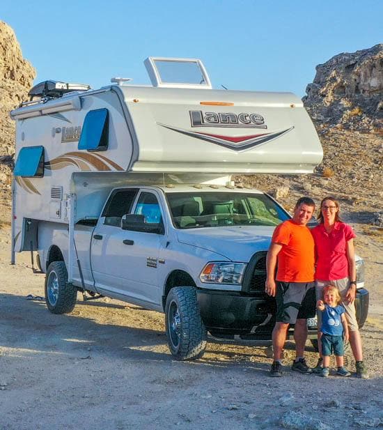
Today, if we can continue this adventure, it is above all thanks to our blog, Smartrippers! We created it one day in 2016, with the desire to share our good travel tips, without thinking that it would lead us there! We have developed it a lot over the years and have become experts on our 3 favorite destinations: Hawaii, Iceland and the American West. We now guide you to these destinations to help you plan the trip of your dreams!
Follow our adventures!