- United States
- Nevada
- Little Finland (Devil's Fire): the mysterious ochre formations of Nevada

Here you are in the state of Nevada, and like many tourists, you have been able to stroll in Sin City: Las Vegas. We propose you through this article to discover a little-known place, located a hundred kilometers from the madness of the Strip and its casinos each more extravagant than the other.
Let's discover Little Finland or Devil's Fire of its appellation of origin.
Summary
1What is Little Finland?
Little Finland, or Devil's Fire, is a plateau of ochre rocks with strange and fascinating shapes, located in Nevada, not far from Las Vegas and near Lake Mead. Little Finland is an incredible and little-known place for explorers looking for peace and adventure.
On the spot, you will discover an impressive promontory, easily accessible by foot, dotted with countless rocks with incredibly chiselled and chaotic shapes, reminiscent of fish fins, hence the name "Little Finland". This popular name was given to the area quite recently with the arrival of a few explorers who came to discover the site. There is also the name "Hobgoblins", but the original name would be "Devil's Fire" or "Bielzebub's Own Fire" whose name was found in archives of the early 19th century.
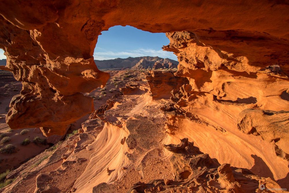
If you love adventure, exploration, and lonely places, then you won't be disappointed! There's a good chance you're even the only ones on site, as the area only welcomes a few cars every day.
However, the difficulty of access to Little Finland will reserve this place for adventurers and photographers. The interest can be limited for those who see in these formations only simple strange rocks.
2How to get to Little Finland?
A 4WD is mandatory to get to Little Finland. From Interstate 15, it will be necessary to reach Riverside via Riverside Road, then take the Gold Butte Road for nearly 34 km (21.1 miles) before entering a 4WD track which will allow the approach of Little Finland, skirting, crossing, and borrowing washs.
Access not being easy, here are all the indications step by step.
From Interstate 15 to Whitney Pocket
From Interstate 15, take exit 112 to the tiny town of Riverside, then take Riverside Road across the Virgin River. Just after the bridge, turn right onto Gold Butte Road. This road, paved at first, runs along the Virgin River before moving away in a more arid sector by taking a little altitude. This is where we enter Gold Butte Monument.
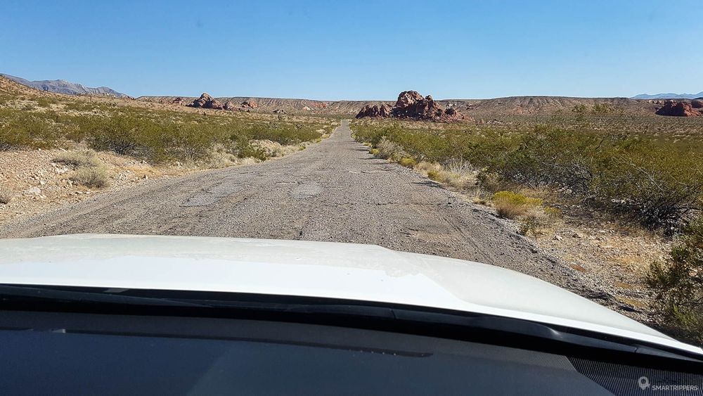
The asphalt gradually fades away to transform the road into a wide, well-travelled path that crosses a dry desert dotted with a few cacti and Mojaves trees. The path continues for about 34 km (21.1 miles) until you reach the Whitney Pocket area.
From Whitney Pocket, a more in-depth look at the 3 possible routes seems to me necessary, as the area is so difficult to understand.
Route 1
32.9 km (20.4 miles) from Whitney Pocket - Pink routeThe first route is the longest and will take you around to the west. Its departure is located 4.1 km (2.6 miles) before arriving at Whitney Pocket, at GPS point "36.508681, -114.196169". Here you will have to turn off on Black Butte Road towards the riverbed which will have to be drained if you want to reach Little Finland.
After 7.5 km (4.7 miles), at GPS point "36.499197, -114.273278", be sure to take the road that goes slightly left to join the "junction" with Creek 113 and Narrows N Road. Then continue for 9.3 km (5.8 miles) to GPS point "36.441416, -114.232075". From this point there will be 7.8 km (4.9 miles) to Little Finland car park at GPS point "36.448297, -114.215072".
Route 2
25.7 km (16 miles) from Whitney Pocket - Blue routeThe second route will take you from Whitney Pocket to Devil's Throat, one of the sights of the area. To reach Devil's Throat you have to take Gold Butte Road south to GPS point "36.432621, -114.143850" from where you have to turn right onto Mud Wash Road. 500m (0.3 mile) further, you are at Devil's Throat.
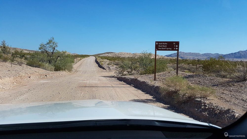
The remaining section to reach Little Finland follows only the Mud Wash Road, the first part in the arid plains, the second in the riverbed which, as for the previous route, will have to be dry to avoid problems with your vehicle. This 10.5 km (6.5 miles) section leads to the intersection with Little Finland Road, at GPS point "36.463806, -114.234688". From here you only have to turn right to reach the Little Finland car park 3 km (1.9 mile) further.
Devil's ThroatIt is a hole about thirty meters (100 feet) deep, formed naturally after the collapse of the ceiling of an underground cave. Be careful here because the hole is still growing today, the rescuers not being on the spot and the frequentation being limited to a few cars per day, it would be unfortunate to fall there to take a picture too close to the edge, to be wounded there, and to wait long hours for someone to arrive to prevent the rescuers who would take long hours to arrive...
Route 3
20.7 km (12.9 miles) from Whitney Pocket - Blue and yellow routesThe third and last route is an alternative to the second route which saves 15 minutes and 5 km (3.1 miles) but will make you miss Devil's Throat. This is the route we took when we came in 2017.
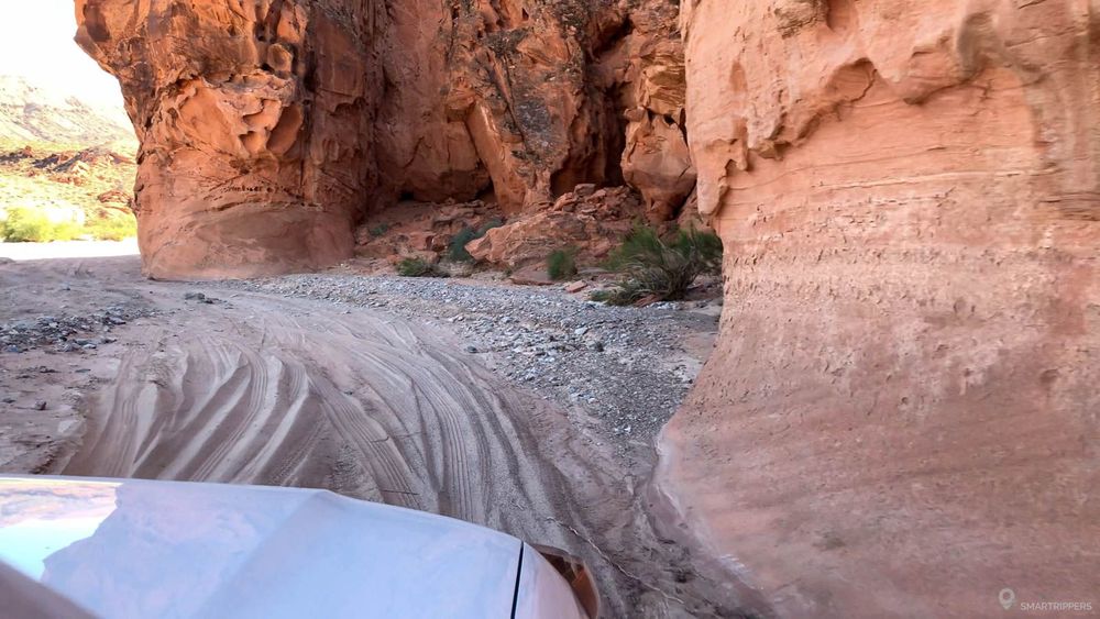
From Gold Butte Road, turn right at GPS point "36.475419, -114.164244" on Mud Wash N Road which follows the riverbed to Mud Wash Road after 5.1 km (3.2 miles) to GPS point "36.443137, -114.189038". From here turn right and follow the same road as the end of route 2 to Little Finland Road.
Once on the spot, you will have to park on the small improvised parking located at the very end of the track, which is bordered by a barbed wire fence.
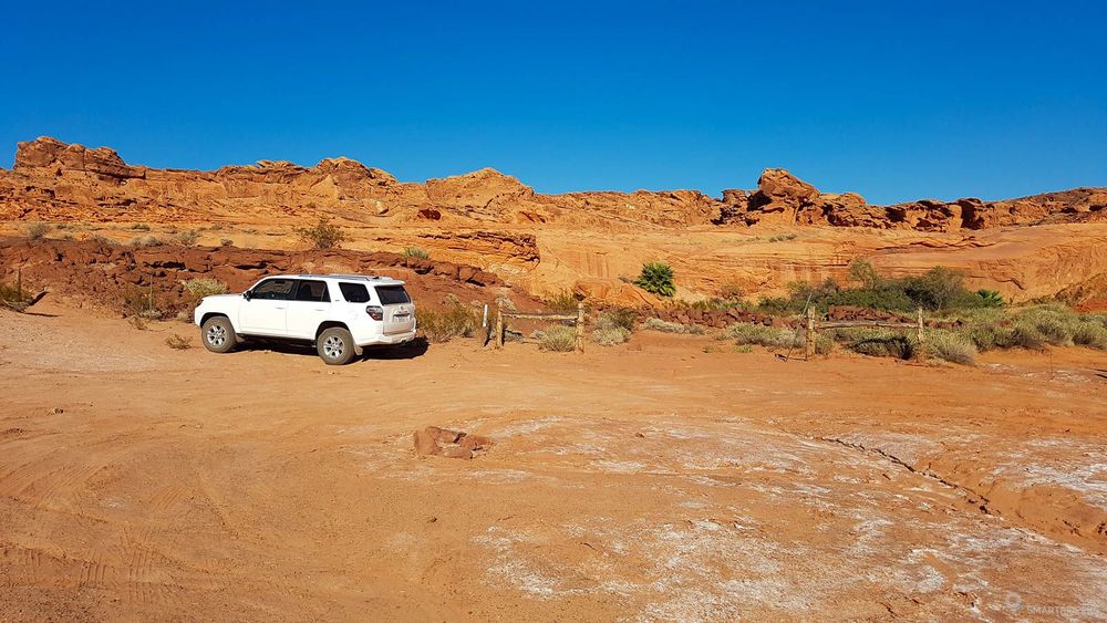
The area being isolated and far from everything, it will also be necessary to be able to devote a good half-day to it, the time to reach it but also to explore the zone. Sleeping there in the wild is a very good option (see below).
3What vehicle do I need ?
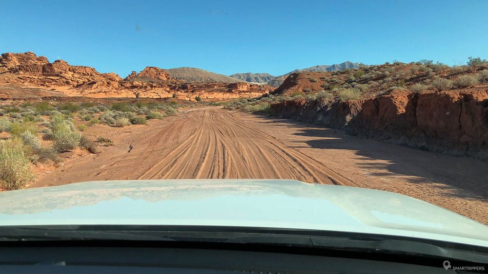
A 4WD with good ground clearance is essential to get to Little Finland. The terrain is rather uneven because the topology of the area can change radically depending on flash floods. If the latest floods are recent, access may be much more difficult. In this case, crossing washs could be more difficult, the banks being steeper.
However, if the area has been dry for a long time, the difficulty will be less. This was the case when we came by at the end of September 2017. Access was easy with a Toyota 4 Runner.
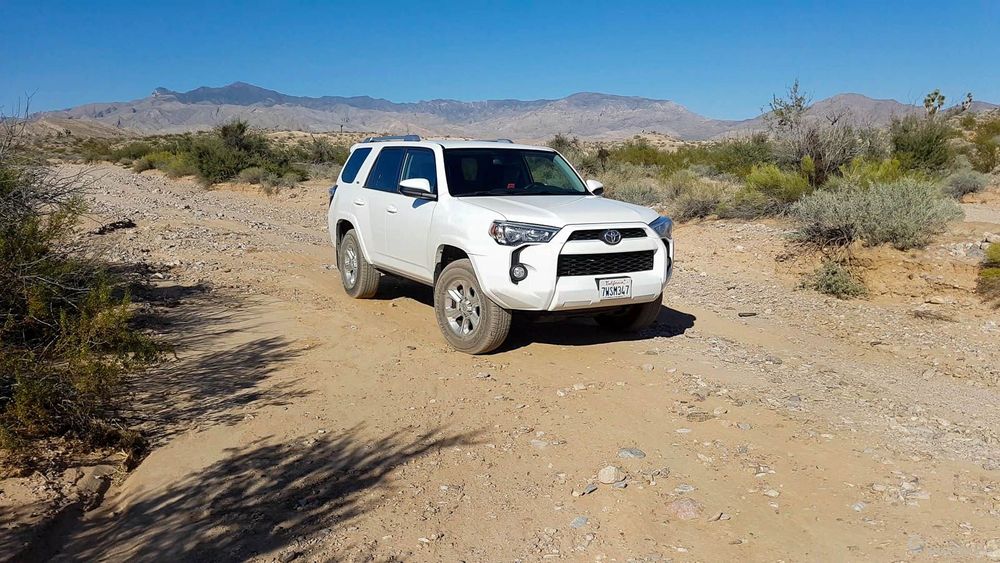
We were able to try out route 2 and 3, and the Gold Butte Road and Little Finland Road are pretty good. The Mud Wash Road and Mud Wash N Road were on the other hand rather chaotic with many passages in the bed of washs, but quietly passable with a good 4WD, on condition that the ground is very dry.
Note that in case of rain, access could be impassable and the area become very dangerous due to the very high risk of flood formation. So be very careful before you commit to it.
4What to see in Little Finland?
Little Finland is to be explored by foot. Here, you will probably be the only ones to freely explore the vast plateau of strange rocks. You can sneak between the sculptures to find the most tortuous and/or photogenic shapes. You will need at least one hour on site, or more if you want to discover everything.
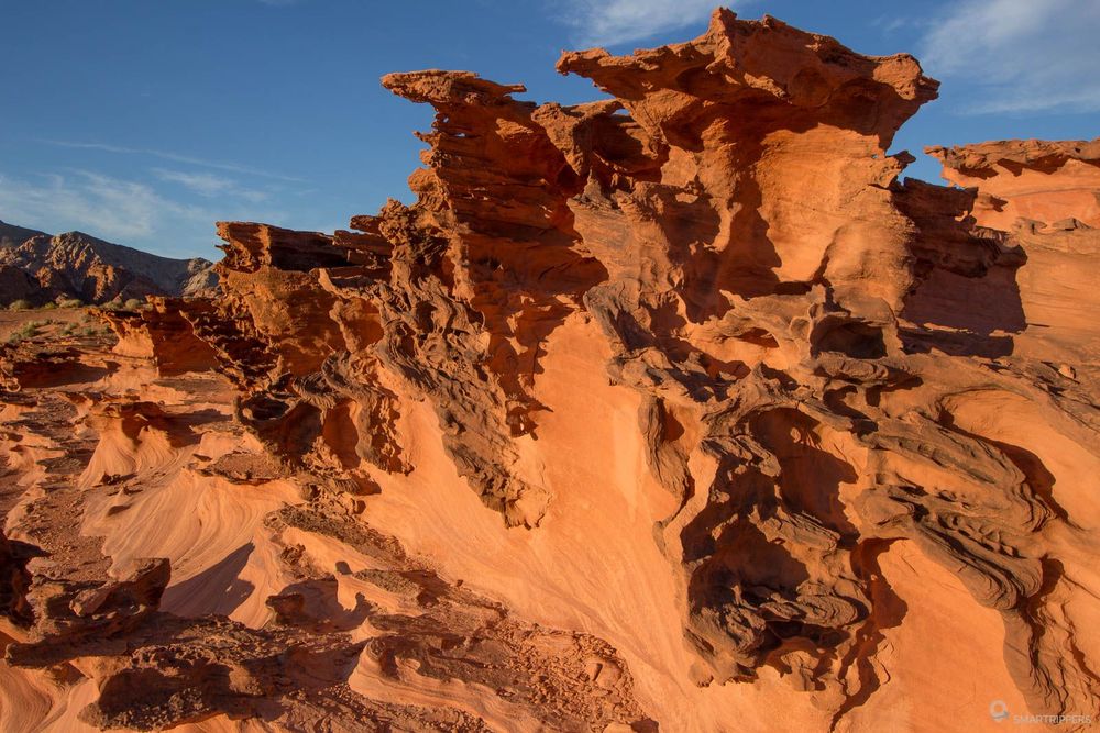
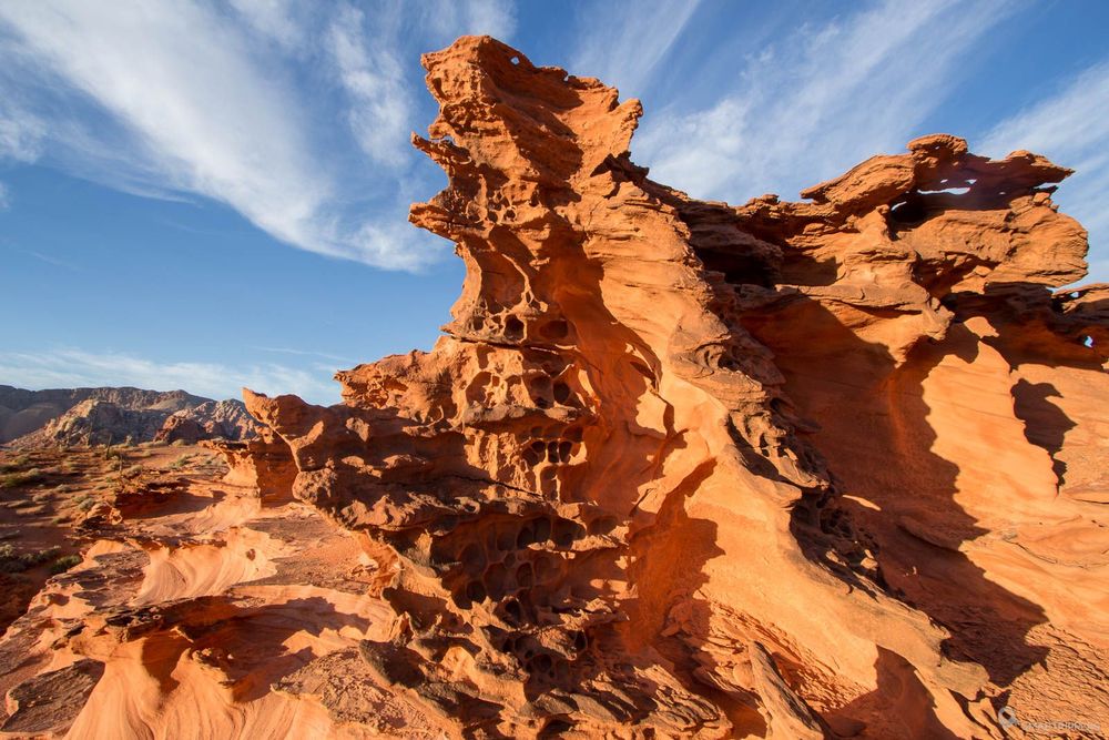
From the parking lot, a small path leads to the plateau (see the red trail by zooming on the map at the bottom of the article). There are two access ways, one to the north and one to the south. We recommend you to take the path going south to join the plateau, explore it, then go back up to the north end, from where you will locate more easily the path allowing you to return to the small car park. his will allow you to make a loop.
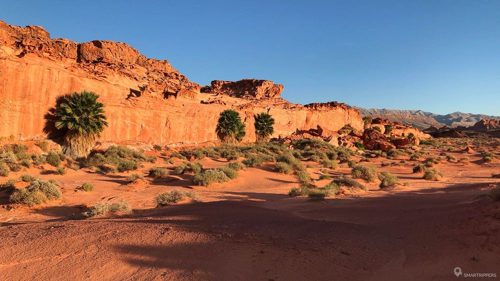
The path that goes south follows the bed of a dry stream, gradually going up towards the plateau. When you find that the top of the plateau is easily accessible without too much climbing, leave the trail and start climbing to explore the area. Feel free to venture out, discover all the subtleties of the formations and find the best angles to make incredible photos.
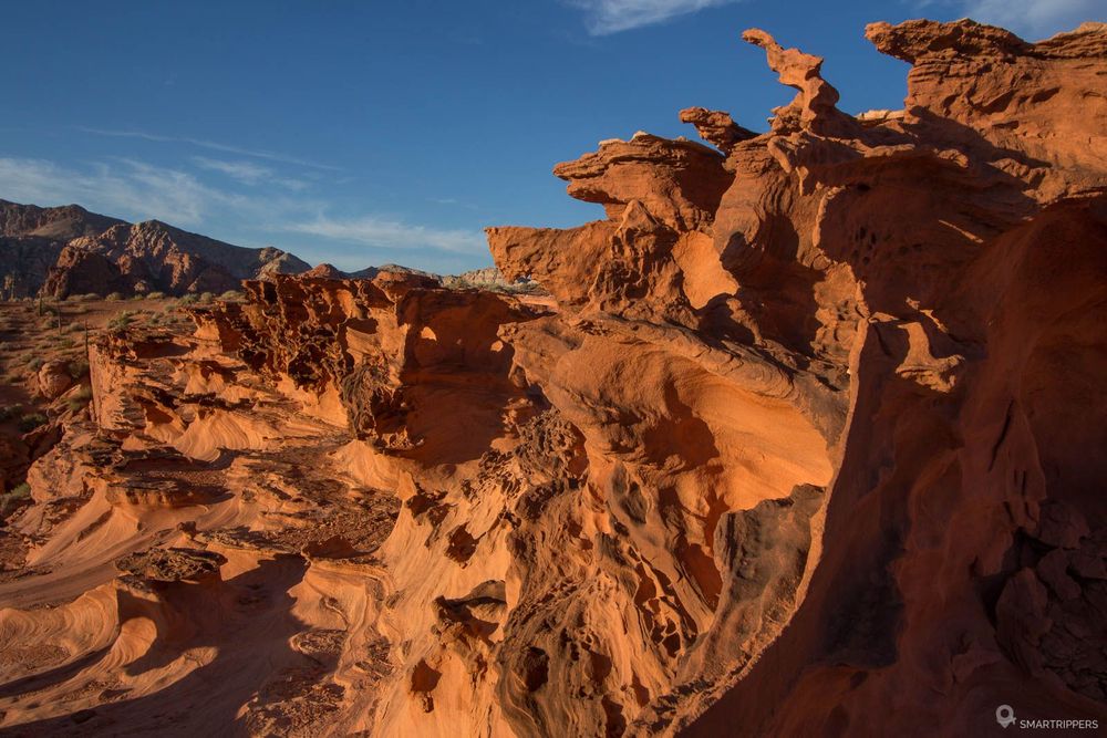
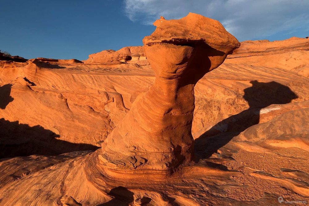
You will notice that there are several interesting areas on the whole plateau, some being richer than others on an "artistic" viewpoint. Take the time to explore every nook and cranny, you won't be disappointed. On the ground, you will soon see whitish marks. These are traces of salt contained in the rock, which offers a striking contrast with the almost red colour of the rocks.
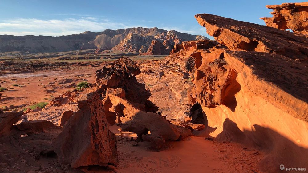
Note that the zone conceals petroglyphs, so be careful not to damage them, nor erode the ochre forms which are very fragile.
5When to come to Little Finland?
Little Finland is accessible all year round if the access roads are practicable. However, avoid going there if it has rained a lot in the previous days or if the sky is threatening. The risk of floods is very high.
Another point of vigilance: the heat. The area being located in a desert, temperatures can be extreme there especially during the summer. So avoid the hottest hours to discover the area, especially since too vertical a light will not make beautiful pictures. Prefer the sunrises and sunsets which bring out the ochre colours of the rocks and offer a striking contrast with the blue of the sky, especially as these hours are less warm.
In any case, do not venture as far as Little Finland without bringing a lot of water with you. In case of technical or other problems, you will be very far from the help especially as we had no service on our phones the time we were there, so better be careful.
6Where to sleep near Little Finland?
As the road is difficult to reach this remote place, it is preferable to spend the night near Little Finland in backcountry camping, which has the double advantage of being able to make you benefit from sunrises and sunsets by already being on the spot. For those who prefer the comfort of a hotel, the city of Mesquite is an ideal drop-off point.
Backcountry camping
Backcountry camping is permitted at Gold Butte National Monument. You can choose to set up your tent or sleep in your 4WD directly in the Little Finland parking lot, or you can spend the night in the Whitney Pocket area, which has several small car parks where you can spend a quiet night. If you choose this second option, remember not to delay too late at the end of the day to avoid making the return track in total darkness.
Personally, we arrived in the middle of the afternoon in the area and visited Little Finland until sunset. Then we came back to Whitney Pocket at nightfall. The few car parks we had spotted at the beginning of the afternoon were already occupied by solitary vehicles and we did not want to come to settle down beside them. As a result, we criss-crossed the roads in the light of our headlights to find a location. Soon enough, we found a perfect spot on a large parking lot at the beginning of Whitney Pass Road. We spent the night there immersed in an indescribable silence !
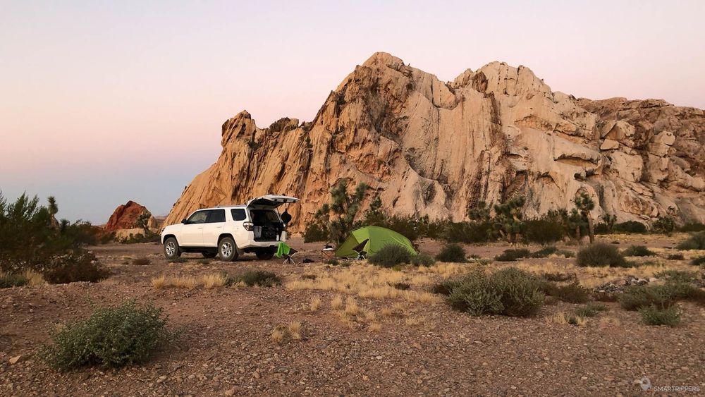
Feel free to explore the surroundings of Whitney Pocket as the area is home to some curiosities that deserve to spend a little time there.
The comfort of a hotel room
If you prefer the cosy comfort of a hotel room, we recommend you to stay in Mesquite - see available hotels, a small town located on the border between Nevada and Arizona. Here the prices are very attractive to spend a night and the city is big enough to offer many restaurants.
In this case, plan not to leave Little Finland too late to reach Whitney Pocket before nightfall. The rest of the road won't be a problem. It will take about 2 hours by car to reach Mesquite from Little Finland.
The incredible shapes and contrasts with salt.
Be alone for half a day exploring the area.
The heat that can make the experience much less enjoyable. There is practically no shade on the spot.
We are Sandrine and Flo, French thirty-somethings. In 2019 we quit everything to live our dream, become nomads and travel around the world. We left with our baby, Lena, who was only 5 months old at the time. After a first trip around the Pacific Ocean by plane and a long 3 months stay in Hawaii, we left to discover Iceland for 3 months on board our 4WD pickup truck and truck camper. Then we continued our adventure in North America.
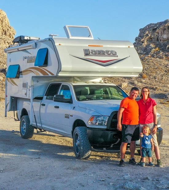
Today, if we can continue this adventure, it is above all thanks to our blog, Smartrippers! We created it one day in 2016, with the desire to share our good travel tips, without thinking that it would lead us there! We have developed it a lot over the years and have become experts on our 3 favorite destinations: Hawaii, Iceland and the American West. We now guide you to these destinations to help you plan the trip of your dreams!
Follow our adventures!