- Iceland
- West Iceland
- Discover Snaefellsnes: the peninsula tour in 12 stages
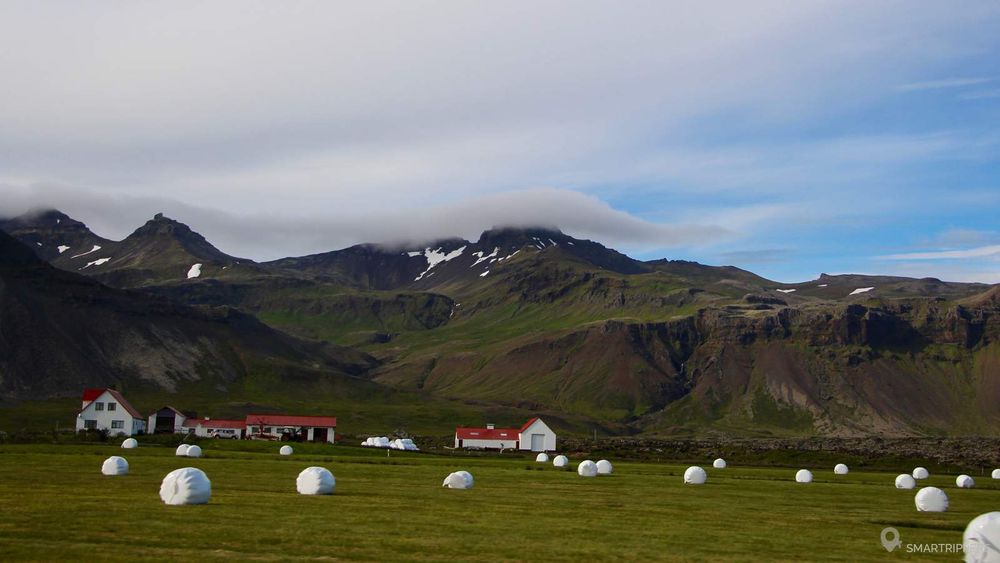
The Snaefellsnes peninsula is located in the west of Iceland. To locate it, take a map of the country and locate the 75 km by 20 km long and 20 km wide arm of the land that runs into the ocean north of Reykjavik, just below the Westfjords.
The landscapes of the Snaefellsnes Peninsula are unique and varied. Here, Iceland reveals another facet of its territory. Between steep coasts and mountains, sandy beaches and lava fields, the peninsula has everything to seduce us. It is one of the great favorites of our trip.
Summary
1To go to the Snaefellsnes Peninsula
The peninsula is easily accessible from the Icelandic capital. In fact, in good weather, from Reykjavik you can easily see its great volcano whose summit is covered by a glacier: the Snæfellsjökull. By car, it takes about 1.5 hours to drive the 110 km to the beginning of Highway 54 using Route 1 and the tunnel south of Borganes, which is charged ISK 1,000.
It is also possible to reach Snaefellsnes from the north. If you are on Route 1, you can either take Route 60 to join Route 54 if you want to stay on the main roads, or take either Route 59, or Route 586, a more direct but much more winding secondary route.
If you are coming from the western fjords, 2 options are available to you. You can either go down along route 60 and then fork on route 54 or take the ferry to Brjánslækur. This one joins Stykkishólmur in 2h30. See schedule and prices
The discovery of the Snaefellsnes peninsula is very well interspersed in the continuity of a tour of the island. It is possible to go through it in both directions, we have no preference on this subject.

2Time to be allowed to discover the Snaefellnes peninsula
We advise you to book 2 days to cover the peninsula, enough time to cover 160 km of road if you choose to make the small loop via Route 56, or 240 km of the large loop via Route 55.
In summer, it will also be possible to make a day trip from Reykjavik on a big day, but you won't have time to discover the peninsula as a whole. In winter, we strongly recommend that you spend 2 days there because the days are shorter, so you won't have time to enjoy it all in one day.
Note that the most interesting part is around Route 574.
3Our 12 steps to discover Snaefellsnes
Gerðuberg columns
The site is located approximately 1.5 km north of Highway 54 via a small gravel road marked by a single sign. Follow the track until you reach the famous Gerðuberg columns which are visible from a distance.
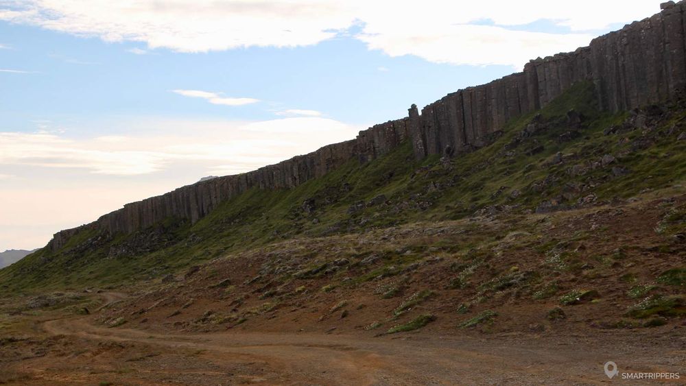
Over a few hundred metres, impressive basalt columns form a vertical wall several tens of metres high. A road that looks more like a 4x4 track allows you to get as close as possible to the columns to photograph them. A second, flatter path also passes in front of the columns.
Our advice: don't go there at the end of the day in summer, because you will be in backlight and won't be able to admire the basalt columns.
The seals of Ytri tunga beach
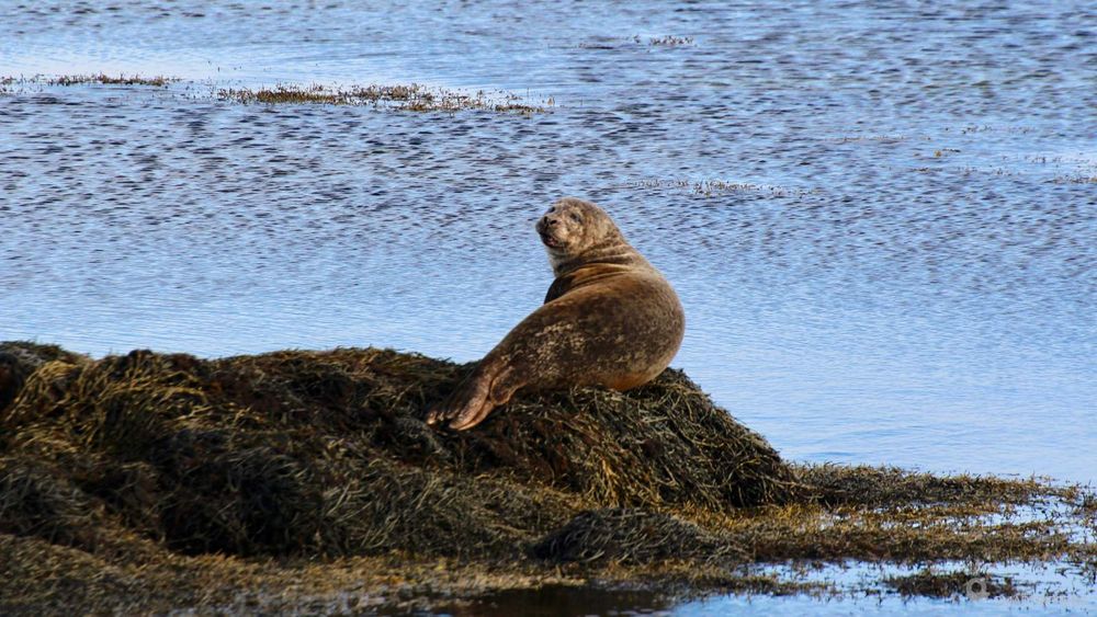
The sandy beaches of the southern peninsula are the ideal refuge for seals that come to rest on the large scattered rocks. We advise you to stop for a few long minutes at the beach of Ytri Tunga where you will have a good chance to see the mammals sleeping the pill in the sun! And on top of that, the beach is very pretty!
Read our full article: Observe the Seals at Ytri Tunga Beach
Rauðfeldsgjá canyon
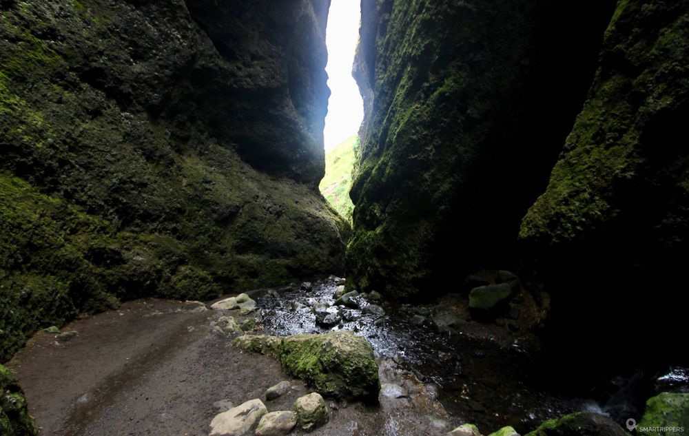
The small canyon of Rauðfeldsgjá was still a secret place a few years ago. Today, although it has become popular, its discovery remains impressive. After a 15-minute walk, you will discover an impressive cave with a river running through it. The most adventurous canoeists will be able to venture inside the canyon by going up the river, where the walls are only a few centimetres apart!
Read our full article: The narrow canyon of Rauðfeldsgjá
Arnarstapi and Hellnar
Arnarstapi and Hellnar are two tiny villages located at the end of the Snaefellsnes peninsula. The interest of the places lies mainly in exploring the coast, very beautiful at this place. Indeed, the 2 villages are essentially preserved to welcome tourism, even if the small port of Arnarstapi is still active.
We will appreciate to walk along the coastline between the 2 small villages that have been shaped by the lava flows cooled by the water. In Arnarstapi, don't miss the beautiful arch of Gatklettur. We then advise you to reach Hellnar along the coast, via a short 4 km long walk to and from Hellnar, or 1 hour. The walk is charming and pleasant. It makes us discover beautiful views of the coast and strange lava formations.
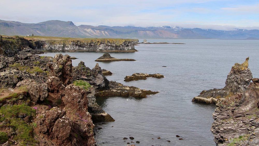
In Hellnar, you can also discover an arch by the beach. It is also possible to reach the village directly by car.
Read our full article: Walk along the steep coastline between Arnarstapi and Hellnar
The basalt sculptures of Lóndrangar
Lóndrangar's impressive sculptures are famous and easily accessible. Together with Mount Kirkjufell, they are one of the emblems of the Snaefellsnes peninsula. From Route 574, a sign indicates the site and a parking lot with a few picnic tables has been set up. From here, a short path takes us to the cliffs where a wooden lookout was built.
From the footbridge, we are still quite far from the impressive basalt forms, but the promontory offers a view of all the concretions as well as the small cliffs and surrounding rocks. The entire coastline was sculpted and shaped by the water, which, by cooling the ancient lava flows, created an impressive relief. Moreover the columns of Lóndrangar were formed by solidified lava in the chimney of an ancient volcano. The highest point culminates at 75 meters above the ocean.
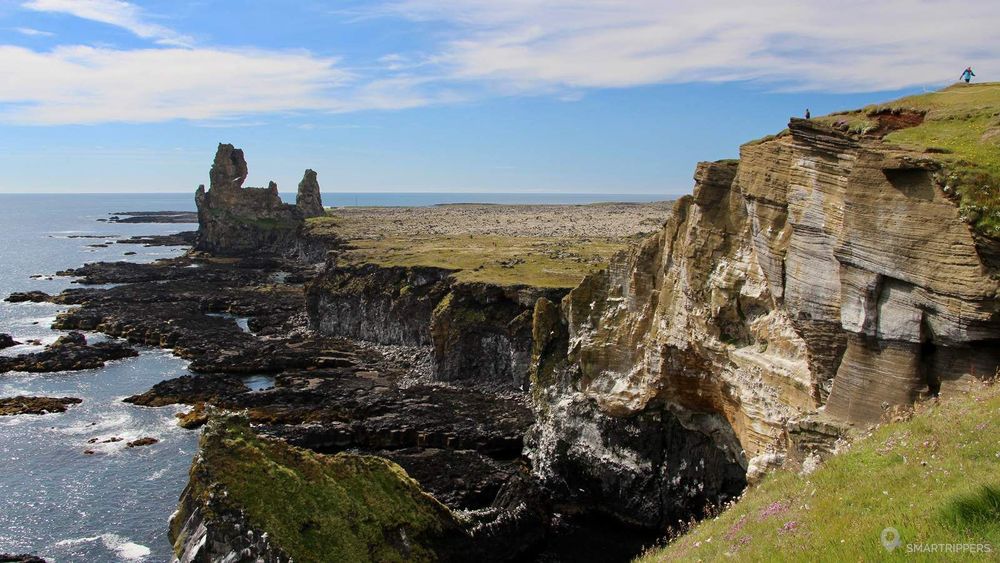
If you want to discover the basalt forms more closely, you can approach them by following a marked path for about 400 meters. This one goes in the direction of the sculptures through an ancient lava flow covered with foam. The walk is very pleasant and will take you almost to the foot of the basalt sculptures.
The Vatnshellir Cave
A large spiral staircase will take you to the depths of the earth 35 metres below the surface, more precisely to a 200-metre long cavity formed by the lava approximately 8000 years ago.

The visit of the Vatnshellir cave is only possible during guided excursions in English. Each participant will be equipped with a helmet and a lamp. The visit lasts 45 minutes. Excursions are organized every hour from 10am to 6pm from May 15th to September 30th and from 11am to 3pm the rest of the year.
Visit price: ISK 3250 for an adult, ISK 2600 for seniors and students and ISK 1000 for young people aged 12 to 17. The visit is free under 12 years old. Children under 3 years of age are not allowed for safety reasons.
It is recommended to book in advance and wear warm clothing, gloves and walking shoes. Information and reservations.
The black beach of Djúpalónssandur
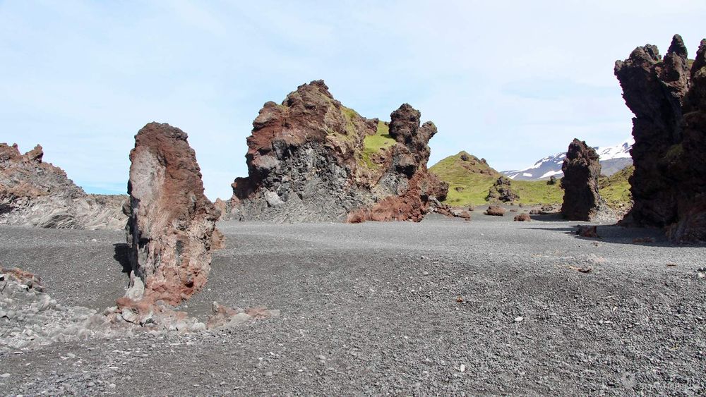
The large beach of Djúpalónssandur is located on the tip of the peninsula of Snaefellsnes. From Highway 574, a small sign indicates the location. Then, you will have to follow a small road for 1.5 km to reach the car park. Picnic tables and sanitary facilities are provided.
From the car park, short paths will take you to several points of view. On clear days, the view of the Snæfellsjökull is magnificent! It is really close by and gives this place a lot of charm.
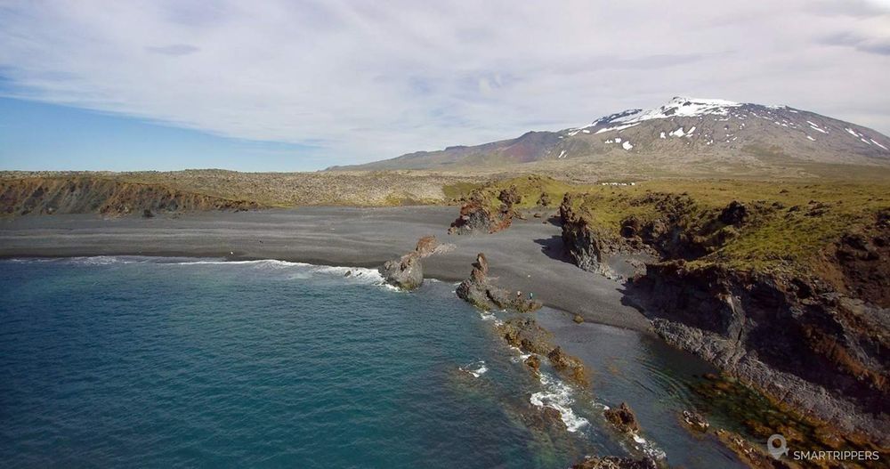
To reach the beach, you will have to walk 200 metres before reaching the first pebbles. Here, there is no real sand, but small black pebbles, which do not make walking easier, even if at the edge of the shore, the pebbles are much thinner and look more like sand.
At the mouth of the beach, an explanatory panel tells how the sailors were selected to embark on fishing boats: 4 large lifting stones were once used to estimate their strength. You will find them in the immediate vicinity of the sign. The biggest, Fullsterkur, which means "full power", weighs 155 kg. The second, Hálfsterkur, or "half the force", weighs 140 kg. The third, Hálfdrættingur, or "weak", weighs 49 kg and the smallest, Amlóði or "useless" weighs only 23 kg. To be able to board the boat, Hálfdrættingur had to be able to carry it all the way to the hips. You can let yourself be tempted by this test of strength and realize how heavy the 2 biggest stones are!
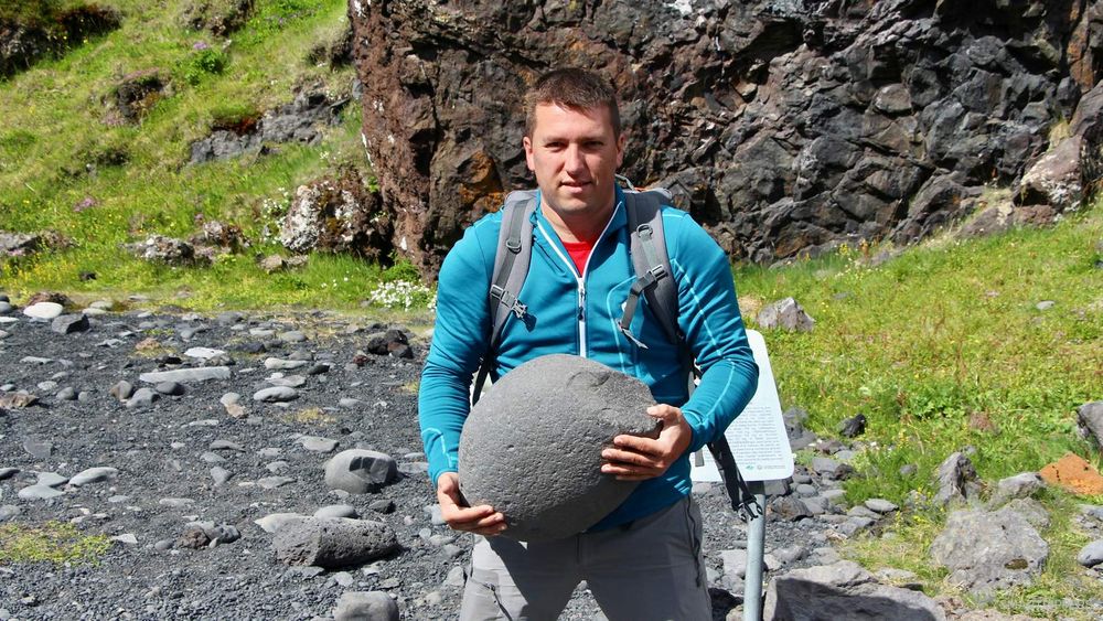
Near the stones, behind the wall of rocks pierced with an arch, there are 2 small lagoons of fresh water, called "Djúpulón", which means "deep lagoon" which gave its name to the beach.
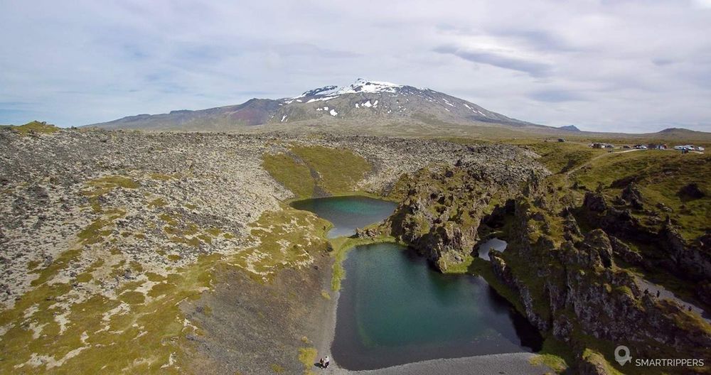
As you step out onto the beach, you will discover strange pieces of rusty steel. The remains of a trawler, the Grimsby Epine, which sank on 13 March 1948. A sign will give you all the circumstances of the accident. The remains of the wreckage are still scattered on the beach today, but the bulk of the carcass is no longer visible.
The crater of Saxhóll
The small crater of Saxhóll is not very well known because it is not well indicated on the maps. It is however located about 400 meters from the road 574, at the end of the Snaefellsnes peninsula. The volcano is only indicated by a very small sign. A path leads to the parking lot. On the spot you will find a summary explanation of the volcano that was formed during an eruption 3000 to 4000 years ago.

A metal staircase was installed to climb the volcano. The steps are first spaced apart and then move closer together as the ascent progresses.
At the summit, you will discover a wide panorama of the lava flows of Snæfellsjökull, as well as other small cones and volcanic craters. The centre of the Saxhóll crater is not so interesting, as it has partially collapsed. We will go up there to enjoy the panorama more than to discover the crater of the volcano.
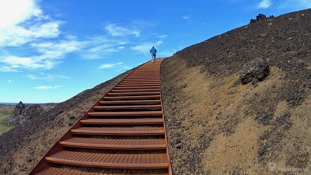
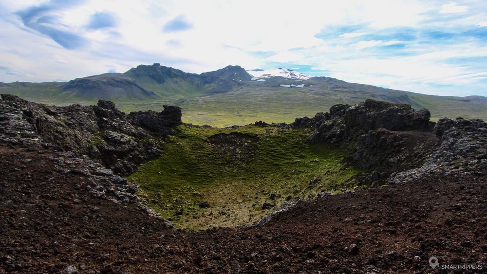
The area being very exposed, there can be a lot of wind at the top.
The Snæfellsjökull
The Snæfellsjökull is the imposing strato volcano that dominates the tip of the Snaefellsnes peninsula. Formed about 700,000 years ago, it remains imposing from the top of its 1146 meters. It is also very visible from Reykjavik in clear weather. Its summit is covered with a glacier, but when the summer months arrive, the snow melts, revealing the rock in some places. In 2012, its summit was exposed for the first time since the recording of data.
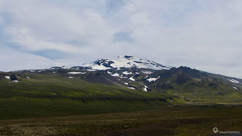
Its last eruption dates back more than 2000 years and its large flows have largely marked the landscape of the peninsula.
During the summer, it is possible to reach the summit by taking the F570 runway (4x4 obligatory). You may see its crater, which Jules Verne made the starting point of his novel "Voyage au centre de la terre". Guided excursions on the glacier will allow you to discover more closely the ice cap of the volcano.
Kirkjufell mountain
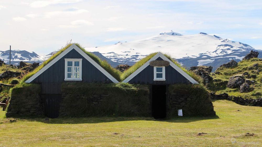
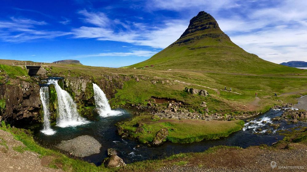
The landscapes of the north coast of the peninsula are very different from those of the south. Here you can visit the mountains, small fjords and pretty villages. Located in the heart of this green and blue ecosystem, Mount Kirkufell is one of the emblems of the peninsula. He is often photographed in the background of the small Kirkufellfoss waterfall. If you come in the summer, don't miss the beautiful sunset colors when the rays light up the northern horizon.
A very small parking lot is available at the edge of Highway 54. From here a short approach walk leads to Kirkufellfoss. The setting is very pleasant, but the path passing right between the waterfall and Mount Kirkjufell, it is quite difficult to immortalize the place without having a tourist in the setting.
Read our full article: Kirkjufell mountain, a magnificent picture from Iceland
Berserkjahraun: Lava field between Grundarfjörður and Helgafellssveit
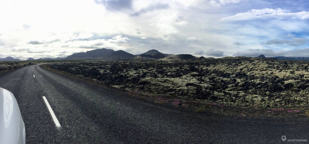
Highway 54 crosses an impressive variety of landscapes in the north of the peninsula. Between the villages of Grundarfjörður and Helgafellssveit, the road crosses a large lava field, the Berserkjahraun, more than 2 km long, with its small volcanic cones well visible nearby. We found this place fascinating, which no map seems to indicate. I don't have much more to say about this place except that it hit us and we stopped to explore the surroundings.
Thanks to Freddy for having found the name of this lava field: -)
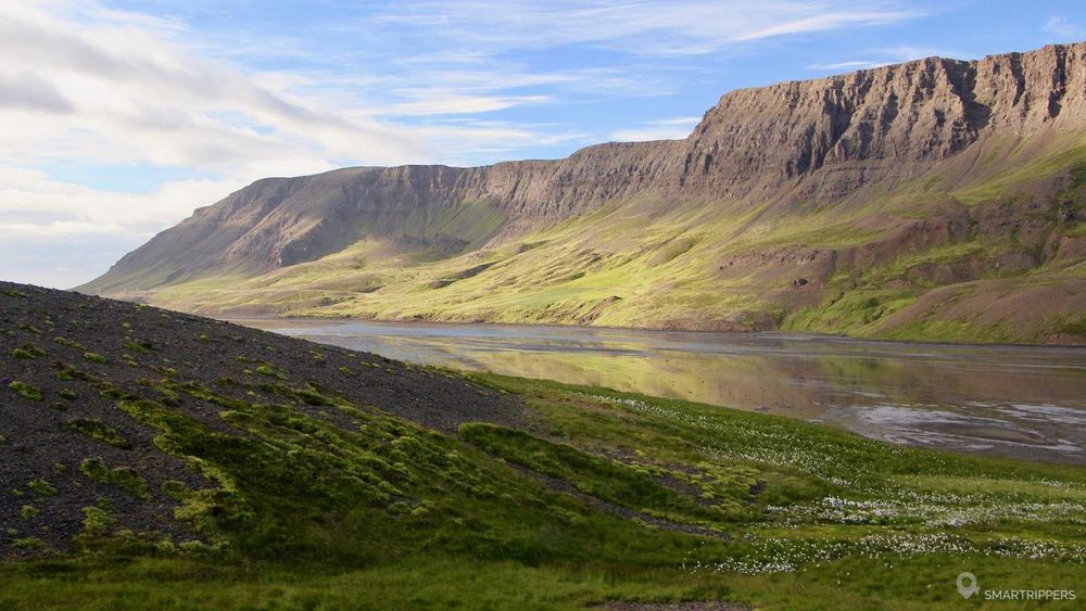
Landscapes around Álftafjörður
The last stage of our tour of the Snaefellsnes peninsula takes us to the sublime landscapes around the Álftafjörður fjord in the north of the peninsula.
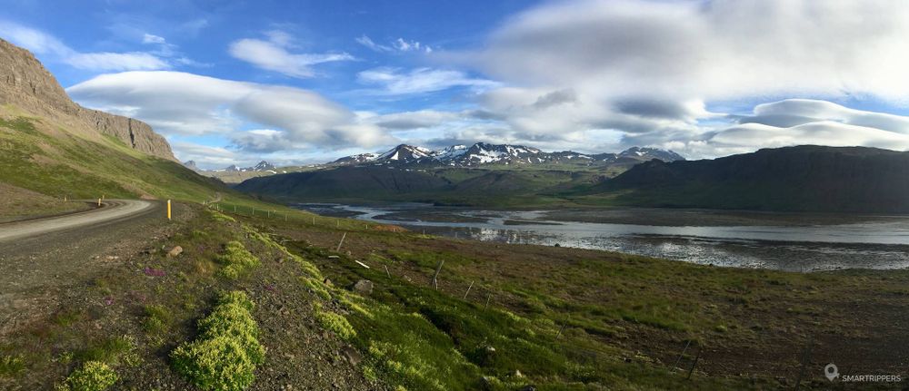
When we discovered Álftafjörður, the sun was beginning to decline. It was late one night in July. The sunlight illuminated the almost vertical rock faces reflected in the calm waters of the fjord. The tide was quite low, with fine sandbanks. On the other side, a completely different landscape was taking shape, with small mountains still scattered with snow marking the horizon.
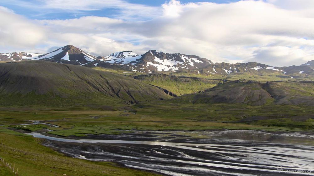
We were alone in this natural setting, contemplating the magic of the place. Here the road is not paved, which adds even more charm to the discovery of this place.
Don't hesitate to drive along Highway 54 to the end of the fjord, you won't be disappointed!
Bonus: Landbrotalaug hot spring
Take advantage of a stopover to bathe in the small pool of Landbrotalaug. It is located near Highway 54 in the south of the peninsula. It is very small and can accommodate only 2 people! A natural stone wall was built on one side of the pond. Note that there are no other facilities.
To get there, follow the 1.2 km southbound track from Highway 54, just after the intersection with Highway 55, continuing westward. At the end, park in the small parking lot. Then walk the last 400 metres on foot.
GPS Coordinates: 64.832249, -22.317952
We are Sandrine and Flo, French thirty-somethings. In 2019 we quit everything to live our dream, become nomads and travel around the world. We left with our baby, Lena, who was only 5 months old at the time. After a first trip around the Pacific Ocean by plane and a long 3 months stay in Hawaii, we left to discover Iceland for 3 months on board our 4WD pickup truck and truck camper. Then we continued our adventure in North America.
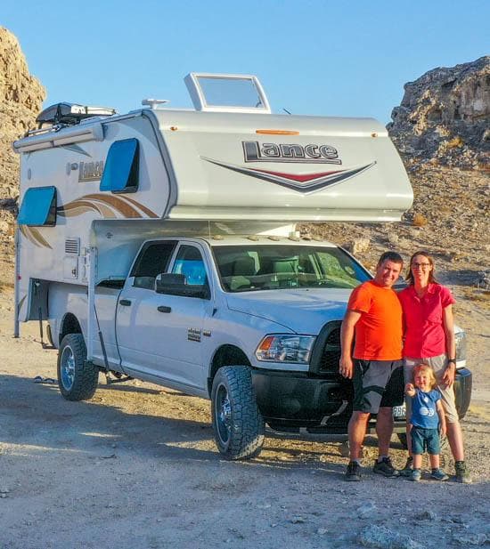
Today, if we can continue this adventure, it is above all thanks to our blog, Smartrippers! We created it one day in 2016, with the desire to share our good travel tips, without thinking that it would lead us there! We have developed it a lot over the years and have become experts on our 3 favorite destinations: Hawaii, Iceland and the American West. We now guide you to these destinations to help you plan the trip of your dreams!
Follow our adventures!